The numbers
How bad is it? In plain numbers.
Five numbers that show the scale of this fire season — each one labelled with exactly what it counts, where, and when.
satellite fire detections across Kalimantan in just 8 days
NASA FIRMS · VIIRS satellite · 10–17 Oct 2026
of land burned across Indonesia — roughly 12× the size of Singapore
Nusantara Atlas satellite estimate · Jan–Aug 2026
on Indonesia's ISPU air-pollution index in Katingan, Central Kalimantan — anything above 300 is officially hazardous
KLHK monitoring stations, via Reuters · 15 Oct 2026
reported cases of respiratory illness across seven fire-affected provinces
Indonesia Ministry of Health (Kemenkes) · Aug–21 Sep 2026
orangutans rescued from burned and fire-threatened habitat
BKSDA West Kalimantan & YIARI · since August 2026
The film
Eight days of fire, in 26 seconds.
What you're seeing: a visualisation built from real satellite measurements — each glow is fire intensity measured by NASA's FIRMS satellites, laid over real Sentinel-2 imagery of Kalimantan and animated day by day, 10–17 Oct 2026. It is a data visualisation, not camera footage.
Why it matters
Fire in peat forest is not like other fires.
The air
Burning peat smoulders underground and pours out thick, toxic smoke. In Katingan the ISPU air index reached 1,551 — more than five times the level classed as hazardous — and the haze drifts across borders into neighbouring regions and countries.
The land
Peatland stores enormous amounts of carbon underground, and the rainforest above it is home to orangutans and some of the richest wildlife on Earth. 895,657 hectares burned across Indonesia in Jan–Aug 2026 alone — and peat fires can keep smouldering for months.
The people
For the families who live here, the smoke is not a headline — it is the air their children breathe. 174,694 cases of respiratory illness were reported across seven provinces in Aug–21 Sep 2026, and the fires disrupt schools, work and daily life for months at a time.
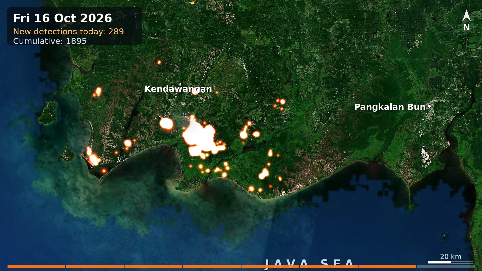
From orbit: the Kendawangan fire complex on Kalimantan's south coast — NASA FIRMS fire detections glowing over Copernicus Sentinel-2 imagery, 16 Oct 2026. A data visualisation, not camera footage.